West Coast Ocean Data Portal's Map Groups Basics
The West Coast Ocean Data Portal is regional resource that connects data, people, and technical capacity across the West Coast
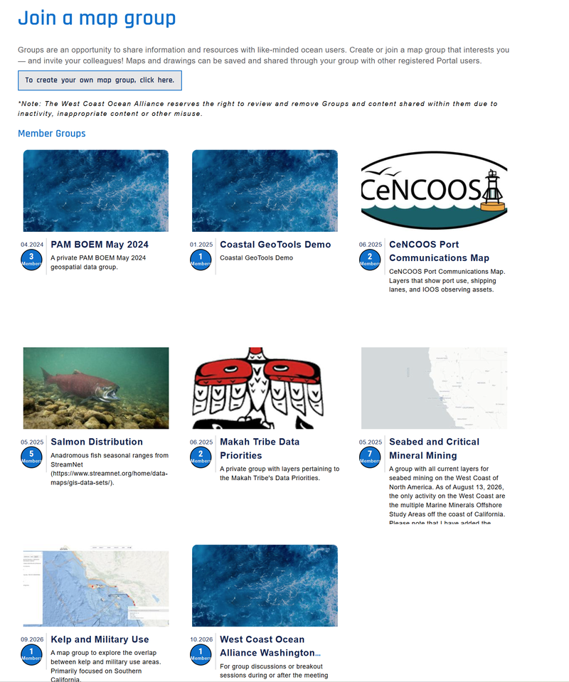
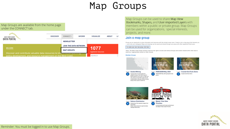
The West Coast Ocean Data Portal's Map Groups uses the special features of the Visualization Tool, an interactive in-browser instance of GIS with curated layers based on West Coast ocean issues.
The Map Groups Features is a powerful collaboration tool that can be used publicly or privately.
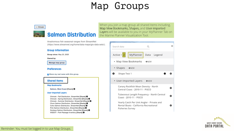
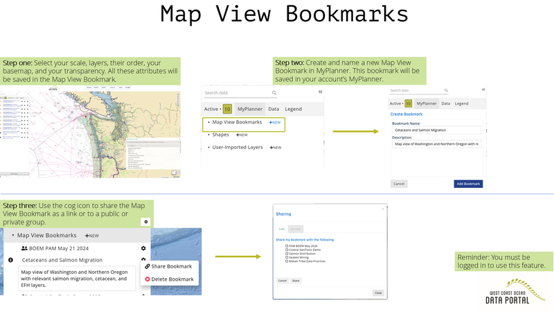
The Map View Bookmarks feature lets you save and share a web URL that shows others the base map, layers, and scale you selected. This feature lets you collaborate in real time and avoids sending numerous shapefiles back and forth.
You can share these bookmarks via link or within a map group.
Do you have preliminary survey design you would like to explore with other spatial layers such as National Marine Sanctuaries and ship traffic?
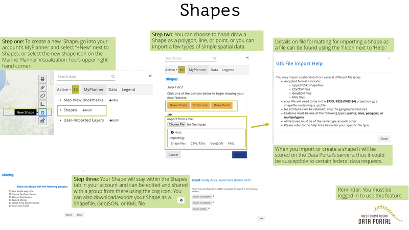
A powerful feature of Map Groups is that you can create, save, and share in-map shapes such as points, lines, or polygons. These shapes can be imported from a file (KML, shapefile, CSV/TSV, or GeoJSON) or drawn with a mouse. These shapes are not public and are saved to your account, these shapes can be deleted at any time. Shapes can only be shared and saved within map bookmarks within map groups.
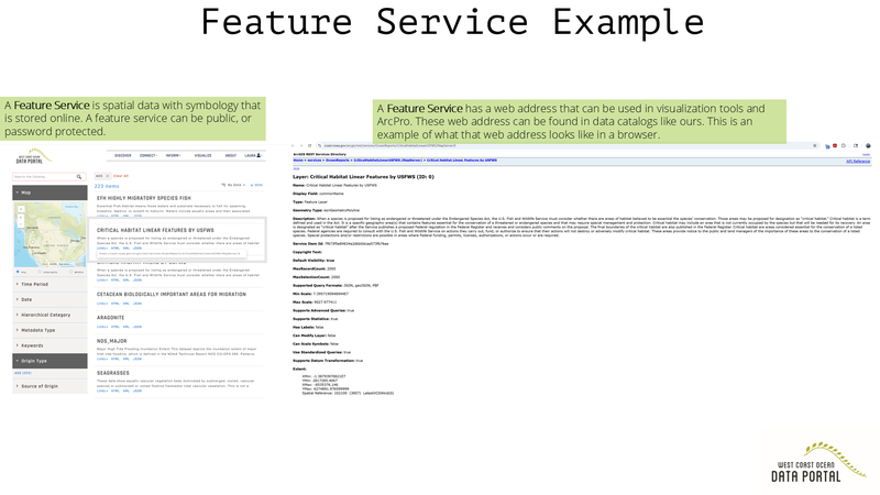
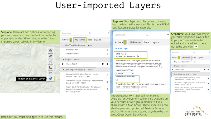
In addition to shapes, you can also import a feature or map service. Importing your own layer will not make it available for everyone, it will only be available on your account or with group members if you share it with a Map Group. These layer URLs can also be password protected. Feature Services not stored anywhere by the West Coast Ocean Data Portal.
What's a feature or map service?
A feature or map service is spatial data stored online and available through a URL. Learn more from ESRI here.