What is a Metadata Record?
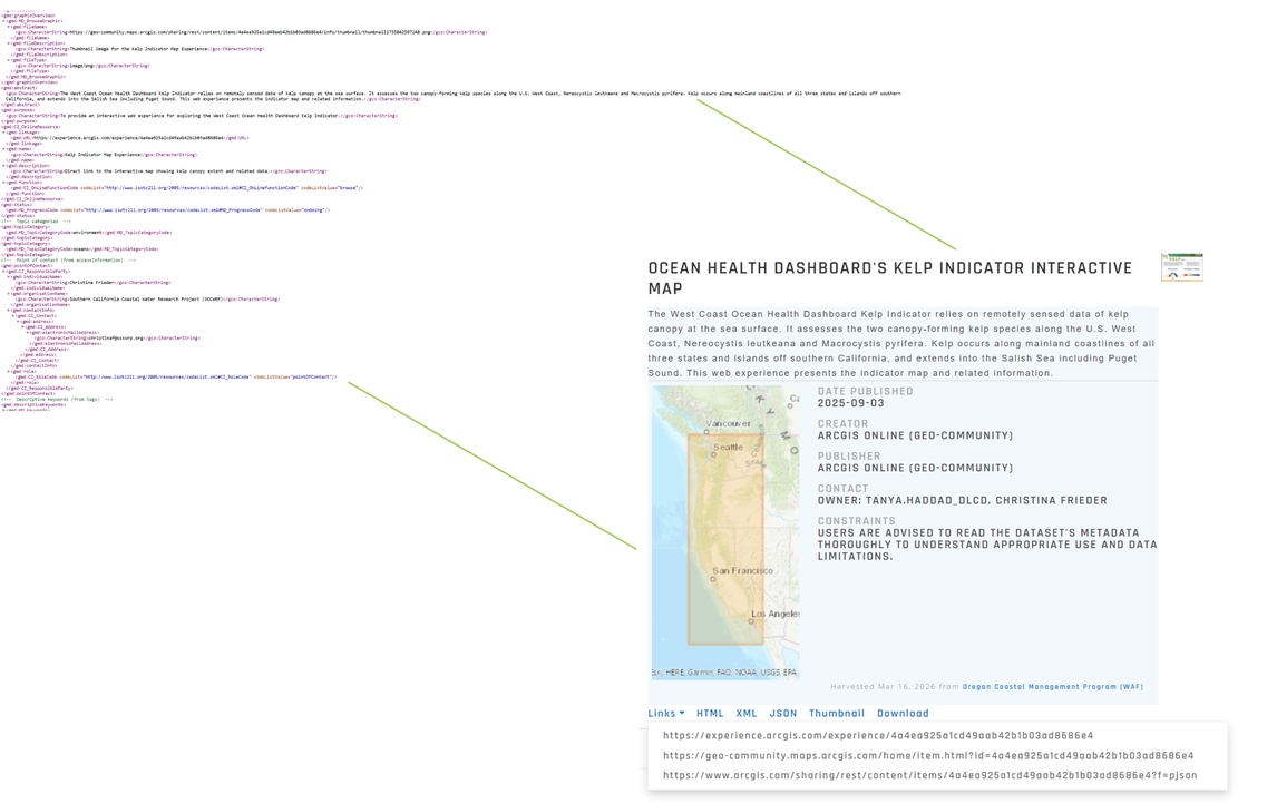
A metadata record is a digital text file of information about a project, tool, or digital data such as GIS files, geospatial databases, or images. This digital text file is often an XML document that follows a template or standard format.
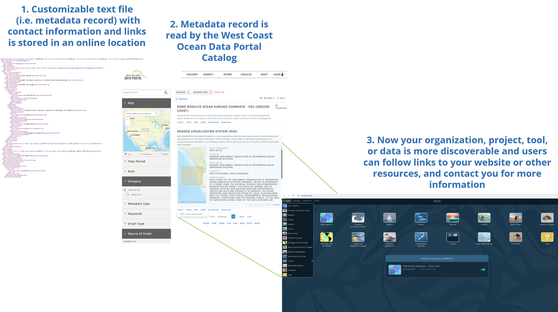
This page reviews the basic physical logistics of a metadata record for portals such as the West Coast Ocean Data Portal and geospatial clearinghouses. To learn more about the usefulness and importance of metadata please explore our Knowledge Base, or other resources from NCEI and USGS.
Metadata records are fully customizable: You have complete control of what is available for portals to find.
Anything in a public folder or server, like ERDDAP, can be accessed and harvested. However, you can share as much or as little information about your project, tool, or digital data as you wish. This makes metadata records a great fit for upholding data sovereignty, the actual data is not available publicly but the information about the data is available publicly.
If your organization does not have the capacity or resources to store or host metadata or data the West Coast Ocean Data Portal can provide matchmaking service that fits the needs of your government or entity.